Descent route: North face, then back up to summit, and down the Mountaineer's route
Mt. Whitney is the highest mountain in the continental United States. It sits in the southern part of the Sierra Nevada mountain range in California. It sees thousands of ascents a year. It has a hike up route via the John Muir trail and the south ridge that sees the most ascents. It also has the Mountaineer's route on the northeast side of the mountain that is a moderate snow climb and rock scramble if you want to do something a bit more interesting that just walking uphill, and then there are numerous technical rock routes on the east face as well.
I have wanted to climb Mt. Whitney for over a decade and had just not gotten around to it. Being in school the last few years really cut into the free time and money needed to take snowboarding trips halfway across the US. I graduated nursing school last year though and am finally enjoying some free time and a decent income again so Whitney went back on my short list this winter.
The southern Sierras do not get a lot of snow compared to the Cascades or even much of the Rockies so I knew I would probably want to try to snowboard the mountain earlier in the season than I would typically try to ride a high peak in Colorado. From what I could tell from online and book research the Sierras often enter into a strong melt freeze cycle conducive to good, safe corn skiing in March and sometimes even February. At work I tend to stack my shifts in a row so I have more days off in a row to take extended trips like this one (I love the nursing lifestyle!).
I watched weather and the avalanche report in the Sierras closely over the winter and sure enough the Sierras entered a spring melt-freeze cycle in mid-March. I also had eight days off in mid-late March that coincided with that time so it was finally time to have a go at snowboarding Mt. Whitney!
With most of my friends either raising kids and/or working Monday through Friday jobs I often find it difficult to find partners for these types of trips and so I often end up going solo. This was the case in this trip too. The weather, the avalanche report, and my schedule synced up though so I decided it was time.
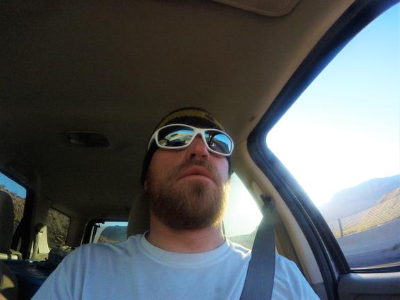
I packed my gear, hopped in my car and took off for a drive across the western US!
photo- Zach Taylor driving across the western US on his way to the Sierras. photo by Zach Taylor
It is a long drive but a beautiful one and I took two and a half days to travel through Colorado, Utah, Nevada, and finally California. The views of the mountains, deserts, and wilderness landscapes that the western US affords are breathtaking even from the car. Just before I crossed into California from Nevada I pulled off the highway and stopped at a gas station.
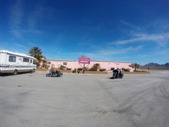
It turned out to not just be any gas station though. Sitting next to it was a brothel. I had never seen a brothel before and I could not resist taking a few pictures. I called my girlfriend at the time, Sam (now ex-girlfriend at time of writing this) and enjoyed a chuckle with her. Along with a brothel and gas station, this little roadside gem also had a liquor store, gun store and a fireworks stand! It was truly the stop of sin. The only thing this little stop was missing was a pot store! Nevada has for some reason decided not to jump on that bandwagon yet.
photo - The Nevada brothel I found when I stopped for gas. photo by Zach Taylor, 2016.
I turned out of the little gas station/brothel/liquor store/gun store/fireworks stand and started driving west again quickly crossing the border into California. I then began driving through Death Valley National Park. Everything was in bloom which I guess only happens every ten years or so. The park was quite crowded but the views were great and I enjoyed looking out on the usually desolate desert landscape that was full of flowers. Nature is a beautiful thing.
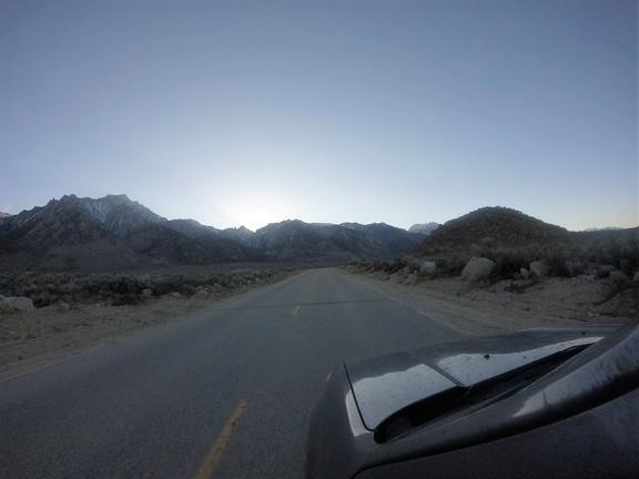
A couple hours later I finally pulled into Lone Pine, California, the town that is located right at the base of Mt. Whitney on the east side. I stopped at a grocery store and liquor store and loaded up for the trip and then drove up to Whitney portal, the trailhead for Mt. Whitney. I was able to drive all the way to the summer trailhead where I set up camp for the night.
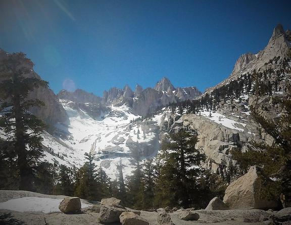
photo - My first glimpse of the Sierras. photo by Zach Taylor, 2016.
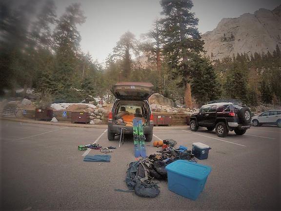
photo- Car camp at the Mt. Whitney trailhead. photo by Zach Taylor, 2016.
It was a pleasant evening and I enjoyed some bratwursts and beer while looking out on all the sheer multi hundred foot high cliffs that overlook the trailhead. I went to bed not to long after dark and got up with the sun to backpack up into the drainage below the Mountaineer's route and set up a base camp. It is about 6200 vertical feet of elevation gain and 15 miles round trip when the road is open to climb Mt. Whitney via the Mountaineer's route so while it is possible to do this in a day, I felt like breaking up the climb into two days would make it more enjoyable and make timing the snow conditions easier too if I got in there and set up a basecamp.
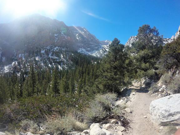
The lower trail was mostly melted out so I booted for a couple miles on solid ground. I hit consistent snow a little below Lower Boy Scout lake but the slope was fairly steep for skinning so I just continued to hike with my splitboard on my back all the way to Lower Boy Scout lake. I had beautiful views of the upper mountain from there and decided to set up basecamp.
photo - The trail below Lower Boy Scout lake. photo by Zach Taylor, 2016
photo - My backpack at the trailhead. photo by Zach Taylor, 2016.
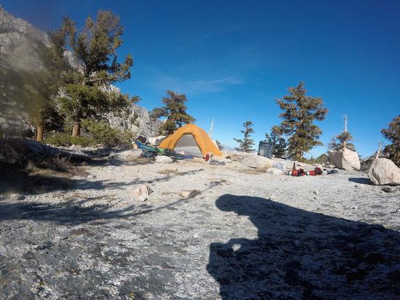
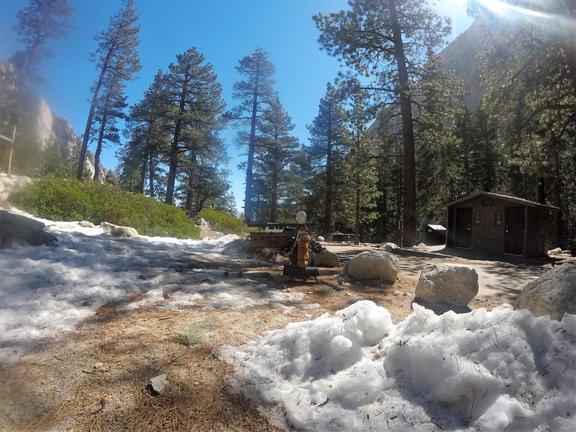
photo - My base camp at Lower Boy Scout lake. photo by Zach Taylor, 2016.
A big rock that overlooked the lake was melted out and I set up camp on top of the rock. The views were beautiful and I laid in the sun admiring the scenery this mountain range I had never gotten to experience before afforded. A guided group camped near me and I talked to them a bit before heading to bed.
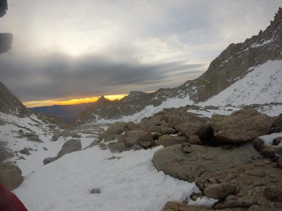
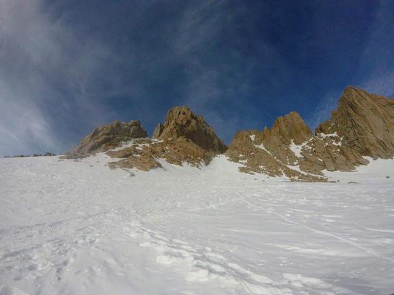
I knew I had a long day ahead of me so I went to bed pretty early and woke up at 0400. I dragged myself out of my sleeping bag and left camp at 0430. I skinned across the frozen lake in the dark and continued up into the basin below Whitney. The good weather over the last week or so had attracted a lot of climbers and I was able to just follow the highway of foot prints in the snow all the way to the base of the Mountaineer's Gully.
photo - Views of the basin below the northeast side of Mt. Whitney. photo by Zach Taylor, 2016.
photo - Views of the basin below the northeast side of Mt. Whitney. photo by Zach Taylor, 2016.
photo - Looking up the Mountaineer's gully on Mt. Whitney. photo by Zach Taylor, 2016.
I took a brief break at the base of the gully and enjoyed some solitude and the early morning sun glistening off the peaks that surrounded me. It was a beautiful day, though a bit chilly. I wondered if snow on the upper mountain would soften up at all. After eating a granola bar and drinking some water I put on my helmet, threw my board on my back, and began climbing up the gully. The snow climbing was fairly easy with a pitch that never really exceeded 40 degrees. The snow surface was totally destroyed by multiple climbers over past days that had climbed it when wet and then the snow surface had refrozen overnight. The surface was easy for climbing but would not make for anything resembling good conditions for my descent. Oh well, it was still a beautiful place and I would be happy just having the opportunity to snowboard down Mt. Whitney even with poor snow conditions.
There were two other people climbing above me that I quickly gained ground on. One of them knocked a rock down the couloir and it went zinging by me. I yelled up at them that they needed to yell rock if they knocked a rock loose. They yelled an apology back. I caught up to them at the top of the gully and they apologized again. It just turned out that they were pretty new to mountaineering and did not know. We talked about the importance of yelling rock whenever a rock is in motion on a mountain and they had the fortune of having a learning experience that did not involve anyone getting hurt.
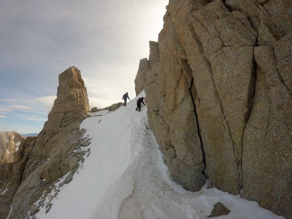
The couple seemed a little out of their element and I offered to finish the climb with them. They eagerly accepted my offer and we traversed across the snowy ledge at the top of the Mountaineer's gully that gives access to Whitney's summit block.
photo - The couple I climbed with traversing across the ledge above the Mountaineer's Gully that gives access to Whitney's summit block. photo by Zach Taylor, 2016.
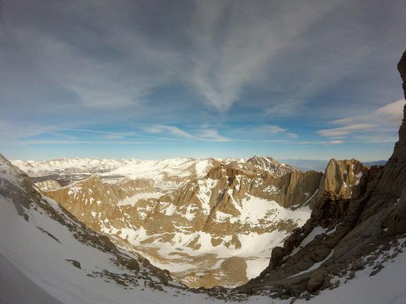
As we traversed the ledge I looked down at the north face of Whitney below us. There were several steep chutes on the face that looked to funnel down into the basin that sits above Arctic Lake. The snow looked a bit hard but at least it was not convoluted like the Mountaineer's gully. It looked to me like I could probably snowboard down one of those chutes into the basin, climb back over the pass between Whitney and Mt. Russell to the north, and then descend back down into the basin I had come from. This would probably provide a better descent than my original plan of descending the Mountaineer's gully. On summitpost.com when I was doing research on routes on Mt. Whitney over the past months I remembered a class 2-3 route mentioned in passing on the north face but had found no other information online regarding the route. I decided to descend the north face on my return.
photo - The north face of Mt. Whitney. photo by Zach Taylor, 2016.
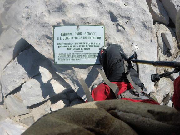
We made quick work of the ledge and then topped out on the summit block of Mt. Whitney. It was a short walk to the highest point....
photo - The summit of Mt. Whitney. photo by Zach Taylor, 2016.
I proudly stood on the summit of this mountain that I had wanted to climb for well over a decade. It was really satisfying to be up there. Many other Sierra peaks around me caught my eye for future descents. I will have to return. There are a lot of great lines in the Sierras!
It was a pretty chilly day and after about ten minutes on the summit, we decided it was time to descend. I walked back down the summit block with the couple (I forget their names) to the ledge that gave access to Mt. Whitney's north face. This is where I split off from them. I dropped into the center chute and they watched me make jump turns for a few minutes before they headed back the way we had come from.
The snow was steep, steeper than it had looked from on top and the snow was rock hard. I carefully made jump turns down this very technical terrain. It was a bit hair raising. At one point I slid out and had to self arrest with my axe quickly to prevent a sure death tumble down Whitney's north face. As I descended I continued to look down for my passageway off the face and into the basin below. I descended well over 1000 vertical feet down the face on steep rock hard snow before I realized I was totally cliffed out. The cliffs at the bottom of the chute were sloped which had hidden them from view up high. Shit!!!
My heart rate was racing and I could feel the epi coursing through my veins. I looked around for anywhere that I could huck or downclimb safely and saw nothing. I buried my axe deep in the snow and took a few deep breaths. "Ok, I can do this," I thought, "I always knew this could happen and I have the tools and skills to get myself out of this, just take it slow and be real careful here" I knew I know had to climb all the way back up the steep frozen face above sure death cliffs to the ledge above and I would be out of the woods. I very slowly built an anchor off my axe, carefully unstrapped from by board, and transitioned to snow climbing. Below is the video of my terrifying descent. The video does not do justice to the pitch of the terrain it was steep! and very hard! Enjoy!
I began kicking steps back up the chute. It was steep and really hard. Have I said that already? I was not happy. It was difficult to kick steps in and I balanced on the tips of my crampon points for a decent bit of the climb back up. It was scary. I have climbed and snowboarded down hundreds of mountains and I knew I had the skill set to get out of the situation but it still scared the shit out of me. I knew I could get cliffed out when I dropped in but did not really expect to actually get cliffed out. It looked like the chute went all the way through to the valley floor from the top when I had looked down. After an hour or so of slow meticulous climbing I managed to finally reach the ledge exhausted.
I took a brief break but the day was getting late and I was still at over 14,000 feet on Mt. Whitney. I traversed the ledge to the top of the Mountaineer's gully and descended the terribly convoluted rock hard snow back down into the basin where I had started the day. The snow sucked and I barely made turns in the gully. I mostly just sideslipped down it to get off the mountain. Finally some snow corned up in the basin below the gully and I enjoyed some decent turns back down to my camp.
I broke down camp and snowboarded and then walked the last bit out. It was a really, really long and scary day. I was very glad to get back to my vehicle and be done with the mountain. I drove back down to a lower elevation, found a campsite off the road to Whitney Portal and slept like the dead for about 12 hours.
*Lessons Learned/Reinforced - I do not feel like I was really reckless in my decision making. I knew I could get cliffed out and I had the gear and skills to get out of the situation but when almost everything went wrong that could go wrong (the snow was steeper than it looked, harder than it looked, and I actually ended up cliffed out on the descent) I pushed myself right up to my limits as a snowboard mountaineer. The fact that someone on summitpost thought there was a class 3 route on the north face lent me confidence that I could find a reasonable way down. What I was on was not third class that is for sure. It was much harder. Always carry an axe and crampons when traveling on or near snow in the high country. Never ski down a line you did not climb up unless you are ready to get cliffed out and know how to safely build snow anchors and transition back to snow climbing. Always maintain a safety margin greater than you think you need. I cut my safety margin way, way narrower than I am usually remotely ok with on that day. If anything else had gone wrong, such as the snow getting too wet and avalanche prone while I climbed back up, I would have really been in some trouble.
Otherwise it was a beautiful mountain and a fun trip. Overall the Mountaineer's route did not seem like that classic of a ski descent to me but it is not a bad ski/snowboard descent with good snow and the novelty of climbing the highest mountain in the continental US and snowboarding down it makes it still worth doing. There are certainly far more classic descents in the Sierra's than what Whitney affords though.