-members of group: Jim Holva, Mark Manko, and Zach Taylor
-ascent and descent route: east ridge
Homestake Peak sits in the northern most area of the Sawatch Mountain range. It is off of Highway 24 between Minturn and Leadville. Homestake is a mountain that I had been looking at for awhile. The day before I looked at weather and it seemed like it might be a good day to get up high and attempt a summit. I spoke to Mark at Beaver Creek and we decided to meet up at his house that night and decide what we wanted to climb.
I arrived at his house and we began looking on the internet to figure out what we wanted to do the next day. Avalanche danger was still bad so we had to be conservative about our route/line selection. I recalled hearing Homestake was a nice, relatively safe winter route. We looked at maps of the peak and pulled up a trip report on summitpost (tr -http://www.summitpost.org/trip-report/481731/homestake-peak-is-this-really-winter-.html ). This supplied the information we needed. Looked like the peak had a decent chance of having a nice snow covered ridge descent with little avalanche danger. We made plans and I left for home quickly to get gear together for the following day.
The alarm went of at the dark and early time of 3:15 am. I picked up Mark and Jim at 4:00am and we began the drive to the trailhead. We drove through Minturn and over the top of Tennesse pass. We drove back down the pass for about a mile and took a right on Lake county 19. We drove up the road briefly to a pulloff on the right side of the road. Here we geared up and began the skin up Wurts's ditch road. We started hiking at 5:30am. We skinned/snowshoed for about 3/4 of a mile before we hit a junction. The sign pointing left said Colorado trail/winter 10th mountain hut approach. The trail straight ahead said Wurts Ditch Road/summer 10th mountain hut approach. The right fork went somewhere else we wern't concerned with. We looked at the map and could see the summer route road was printed on the map. The winter trail was an unofficial trail not on the map.
We decided to stay straight on the summer route since we knew exactly where it was going. We wanted to get to the 10th mountain hut which sits right at the base of Homestake Peak.
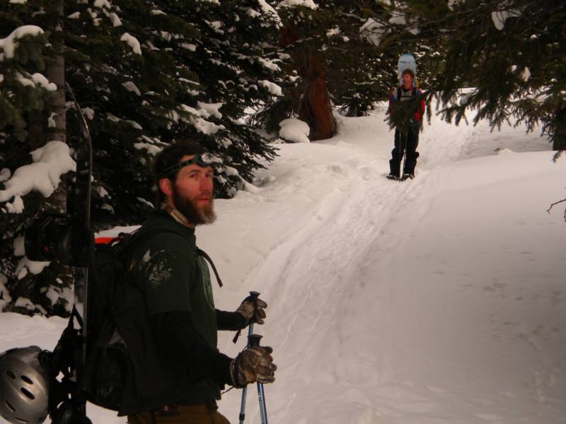
photo- Jim Holva(left) and Mark Manko(right) snowshoeing up the road to Homestake peak. photo by Zach Taylor, 2010
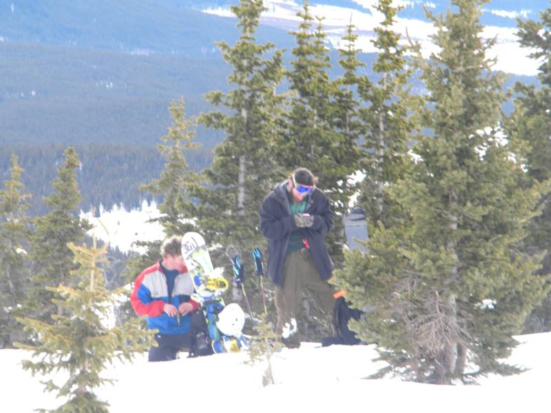
photo-Mark Manko(left) and Jim Holva(right) taking a food break at about 11,400' just beneath the east ridge of Homestake peak. photo Zach Taylor, 2010
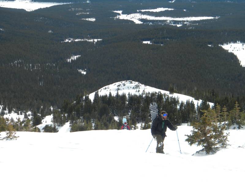
After climbing the peak we returned via the winter trail which I would recommend as the ascent route during the winter as well. The summer trail/road had alot of flat so it is more difficult to descend on skis/snowboard than the winter route that has a more consistent pitch downhill on the return. We continued up into the drainage and arrived at the 10th Mountain Hut at the head of the drainage that Homestake Peak rings on its eastern side. During much of this part of the hike Homestake is obscured from view until you are almost at the hut. Then it clearly climbs above you.
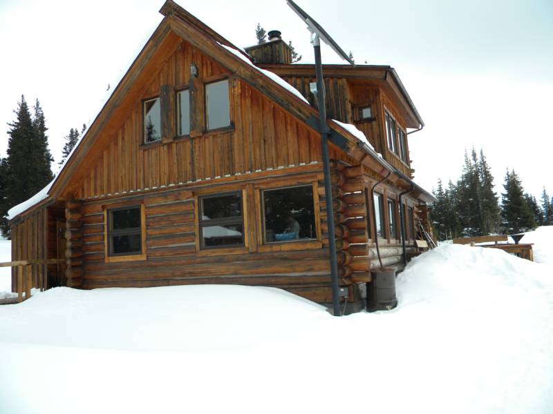
photo-A look at the 10 Mountain Hut/ski cabin. photo by Zach Taylor, 2010
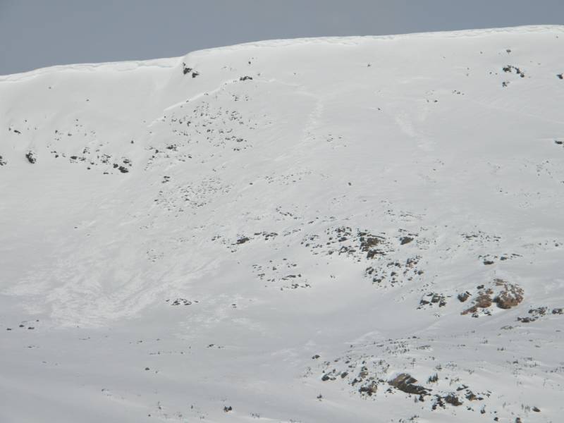
From the hut if you look directly west Homestake Peak is the highest point in the drainage. The standard summer route climbs up to Slide lake behind the cabin and then continues directly up and west on a steep slope that puts you on the ridge between Homestake and point 12,600ish that is just north of Homestake. This east facing slope is extremely dangerous and avalanche prone during the winter. A large cornice runs from Homestake's summit north to point 12,600ish above this headwall. During snow season you would have to climb through this large cornice to gain the ridge not to mention being on large avalanche terrain beneath a cornice from Slide Lake all the way to the ridgeline. We saw multiple crown lines and and avalanche debris that ran hundreds of feet wide and descended about a 1,000 vertical feet.
photo- A look at the avalanche debris on the east facing summer route. photo- Zach Taylor
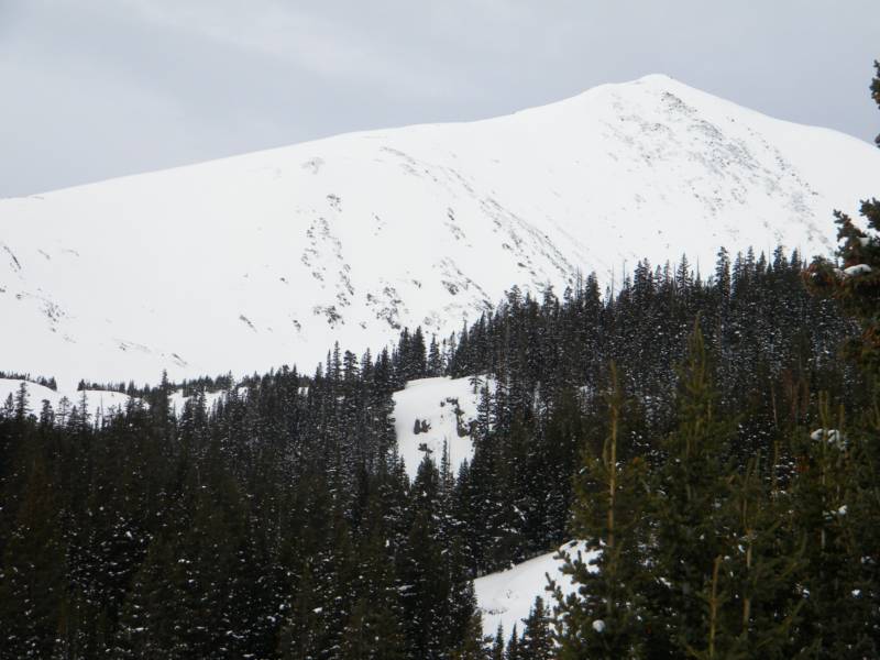
Instead of taking this route we skinned to the southwest and picked up Homestake's east ridge where it descended to treeline. This provided an avalanche safe winter route to Homestake's summit. We stopped briefly at treeline, ate a snack, and continued along the east ridge towards the top. The east ridge is the ridge that is on climbers left if you are looking at Homestake from the 10th Mountain Hut.
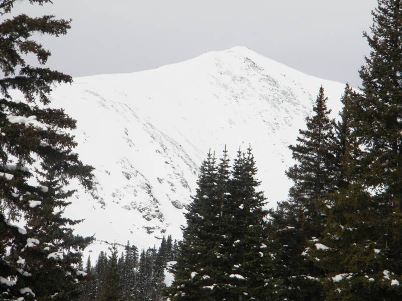
photo- Homestake Peak, the east ridge is to climber's left of the summit. You pic it up just out of view to climbers left in this photo where the ridge meets the treeline. photo by Zach Taylor
photo- Mark Manko(background, left) and Jim Holva(foreground, right) climbing above treeline on the east ridge of Homestake. photo by Zach Taylor, 2010
As we gained altitude and climbed well above treeline. Homestake's spectacular views appeared. We saw the Mosquito, Front, Sawatch, and Gore ranges all very close. Homestake sits almost right at the confluence of these four mountain ranges. As we neared the top the Elk range came into view in the distance as well. I was able to pick out each 14,000' peak in the Elk from Homestake's summit. We arrived at the top at 10:20am. There was a little wind and cold but overall it was pretty warm for 13,209' in the middle of winter.
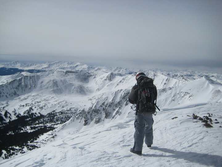
photo- Zach Taylor skinning up the east ridge of Homestake Peak. photo by Jim Holva, 2010
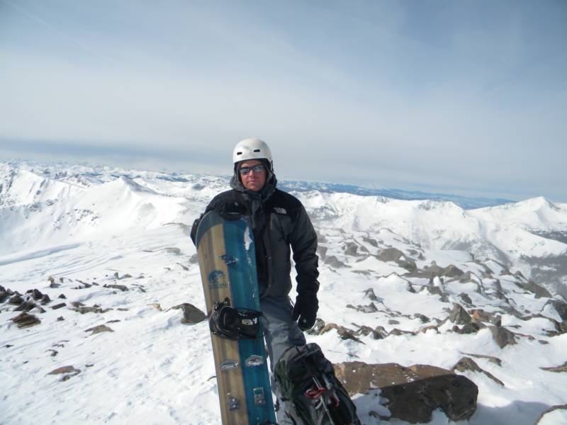
photo- Zach Taylor looking south at the Sawatch mountain range from Homestake's summit. photo by Jim Holva, 2010
photos-summit shots, pictured left Jim Holva. photo by Mark Manko 2010. photo right- Zach Taylor pictured. photo by Jim Holva, 2010
We hung out on the summit for a few minutes taking photos and enjoying the view. Then we geared up and began our descent back down the ridge. We took turns riding and taking photos on our descent. Enjoy the actions photos!
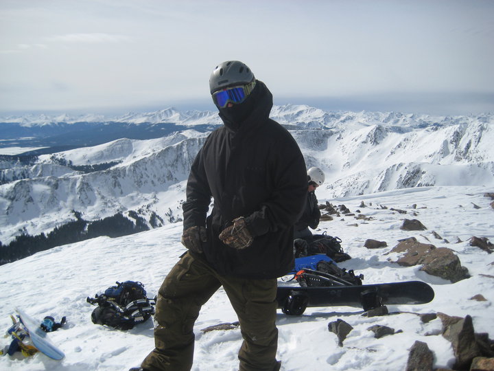
photo- Zach Taylor(left) and Jim Holva(right) getting ready to descend off the summit of Homestake. photo by Mark Manko, 2010
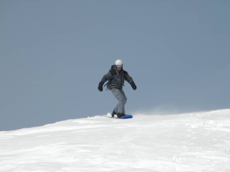
photo- Zach Taylor descending Homestake peak. photo by Mark Manko, 2010
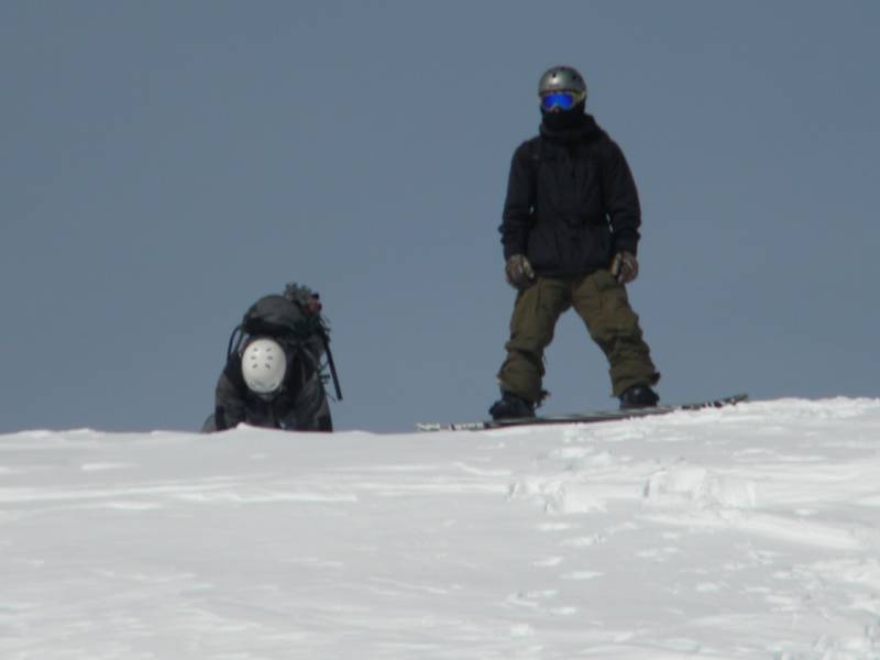
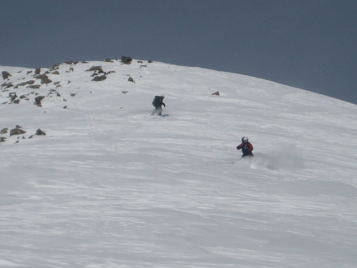
photo- Zach Taylor(left) and Mark Manko(right) descending the east ridge of Homestake Peak. photo by Jim Holva, 2010
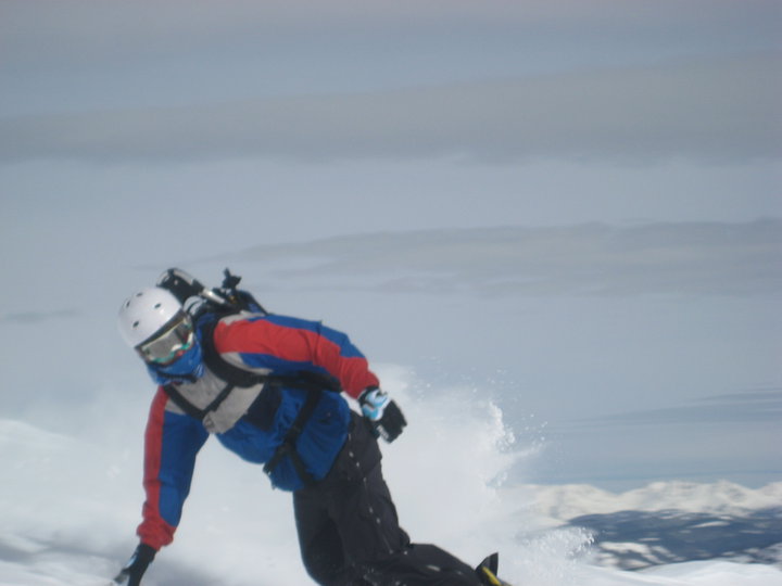
photo- Mark Manko descending the east ridge of Homestake Peak. photo by Jim Holva, 2010
We descended the ridge to treeline and then dropped left back into the basin. We stopped and talked briefly to a group that was skinning up Homestake and had spent the night at the 10th Mountain Hut the previous night. They said that the winter trail was a better descent and we gave them a little beta on the peak. We continued riding down and returned to the cabin.
We stopped here to rub some wax on the boards and pop out the poles for the low angled ride out through the valley.
We continued down the winter trail and covered distance quickly. I was able to ride most of the way down only skating a couple times. The last bit of the winter trail required a hike back uphill for about twenty minutes. Then we rode the last minute or two out to our car and were back at the trailhead at 12:20 pm. It was a good day. Homestake makes a nice winter outing and tour. If you are astute with route finding you can avoid all the avalanche terrain and still get a summit descent.