ascent/descent route: "The Heart" (South-SouthWest Face from Avalanche Gulch.
members of trip: Ricardo Moreno, Mike Bannister, and Zach Taylor.
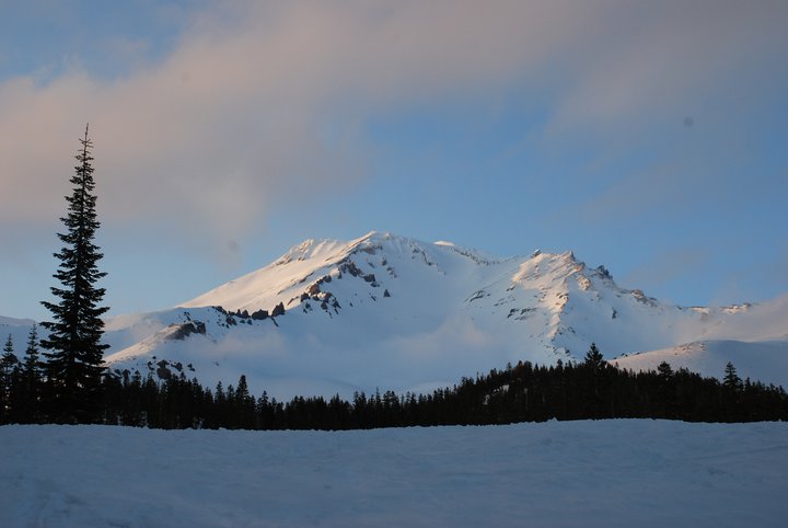
14,162' Mt. Shasta
photo- A look at Mt. Shasta from Shasta, California. photo by Ricardo Moreno, 2011.
5/27/2011- Mike, Pollo, and I had been planning a Pacific Northwest Ski/Snowboard Mountaineering trip for the last six months. Mt. Rainier was our primary goal but we wanted to climb multiple other peaks while we were out there too. Shasta was top on my list but we initially decided that it was too far away and would have to be a goal for another trip. We were getting ready to leave for Rainier and were looking at weather reports for the Pacific Northwest.
There was a low spinning moisture, cold temps, and wind into the Pacific Northwest and most of the range looked to be socked in for the first part of our trip. All of Washington and Oregon seemed to be affected. As I crossed the border into Northern California though I noticed that it looked like Shasta was supposed to have one day (5/30) that might have clear enough weather for a summit attempt. Plans were changed and we decided to head towards Shasta and hope for better weather the next week on Rainier.
5/28/2011- We drove from Avon, Co to just east of Elko, Nevada and camped.
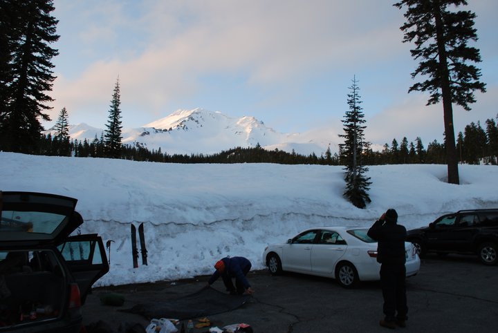
5/29/2011- We arrived in Shasta, California, went to the grocery store for last minute things, and then drove to the trailhead above town.
photo- Mike Bannister (left) and Zach Taylor(right) at the Mt. Shasta Avalanche Gulch trailhead in Northern California. photo by Ricardo Moreno, 2011.
Shasta seems to be quite the international attraction. As I readied my gear for the next day I heard atleast three different languages being spoken around me at different times by the tourists wondering around taking pictures in the parking lot. Two girls walked over and introduced themselves; Jasmin and Megan. They had driven down from their homes in British Columbia for a similar ski mountaineering trip to our own. We all hit it off and hung out in the parking lot for a bit telling mountaineering stories, etc... Eventually we headed to bed and Jasmin and Megan left.
For those of you who do not know, Mt. Shasta is the northernmost 14er in California, the highest volcano in the state, the second highest peak in the Cascade Mountain range (second only to Rainier), and is often used as a landmark by commercial airline pilots in the northern California area. Shasta is regarded by many to be a spiritual place where Gods dwell and strange things happen. There are many Native American stories and legends that deal with their belief in the holiness of the area and one crazy lady in the town of Shasta informed me after my climb that I was lucky to be alive because I had just walked on the face of Jesus by climbing the mountain. I am not one for religion but the beauty of the mountain and area coupled with all of the stories and superstitions surrounding the mountain make for amusing reading and all the factors going into climbing the mountain remind one that this volcano is not a joke.
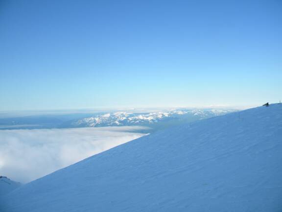
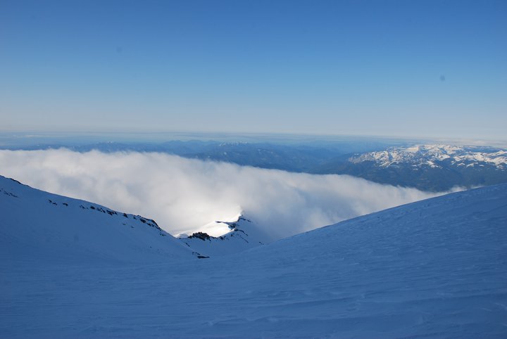
photo- clouds below Mt. Shasta. photo by Zach Taylor, 2011.
The mountain is surrounded on three sides by large crevassed glaciers, steep couloirs, headwalls, and cliffs. It gets the full brunt of storms coming in off the Pacific and its weather is often likened to that of Rainier. We had hoped to do the Bolam Glacier route but because the route would have required an approach day and the following day was supposed to bring much worse weather we settled on a one day, 11 mile, 7,000 vertical foot blitz on the standard route of Shasta via Avalanche Gulch.
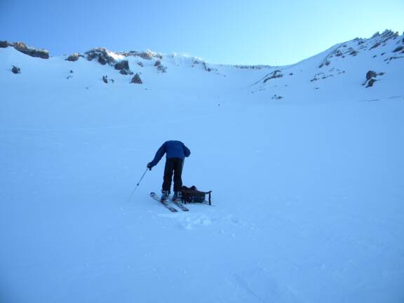
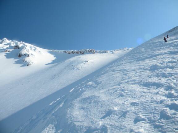
5/30/2011-We set the alarm for 3:00am and were skinning by 4:00am. We made our way towards Shasta in the dark of early morning. As the sun rose a bit we realized that we were on the Green Butte ridge route just above Avalanche Gulch. We dropped off the ridge into Avalanche Gulch proper and continued up the mountain.
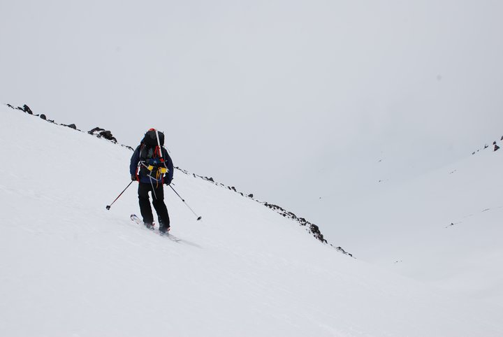
photo-Mike Bannister taking a break in Avalanche Gulch on the way to Shasta's summit. photo by Zach Taylor, 2011.
photo- Mike Bannister and Ricardo Moreno making their way towards Shasta's summit. photo by Zach Taylor, 2011
The day started off sunny but clouds built below us as we neared the top of Avalanche Gulch. Looking down I could now see that the wind was pushing the clouds up the mountain from the southwest, increasing cloud size and moisture content. The clouds continued to rise towards us.
photo- Clouds building around Shasta. photo by Ricardo Moreno, 2011.
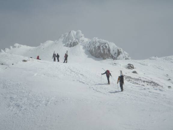
By the time we were out of Avalanche Gulch and making our way up Heartbreak Hill, clouds were swirling around us and visibility was poor to ok and constantly changing. We were near the summit and knew that we would be descending into clouds either way at this point so we continued up to the summit which seemed to stay just above all the clouds swirling around the volcano.
photo- Mike and Pollo making their way towards the summit from the top of Heartbreak Hill. photo by Zach Taylor, 2011.
photo- Mike Bannister high on Mt. Shasta. photo by Ricardo Moreno, 2011
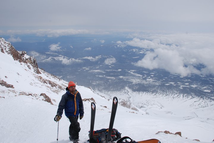
We were greeted with winds sustained in the high 30s and maybe even gusting a bit higher than that. We stumbled in wind the last several hundred feet to the top at about 11:30am. Getting to the summit proper consisted of crawling the last 10 feet, axe in hand, with exposure, in high wind. My summit pictures do not in any way do justice to the wind we experienced on the summit. There was a small enclave in some rocks just beneath the summit that almost completely sheltered us. We made a quick, sketchy trip to the summit, very briefly, and rested/geared up for the descent about ten feet below the summit in our little wind break.
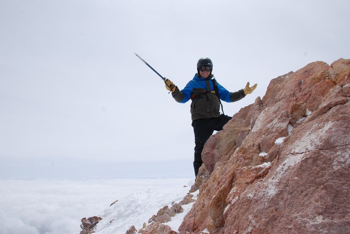
photo- Zach Taylor on the summit block of Mt. Shasta. photo by Ricardo Moreno, 2011.
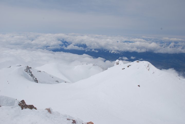
photo- The view from the summit of Mt. Shasta. photo by Ricardo Moreno, 2011.
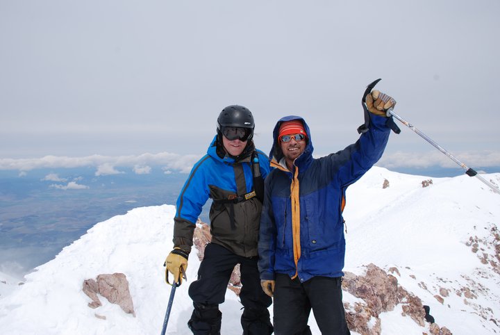
photo- Zach Taylor (left) and Mike Bannister (right) on the summit of Mt. Shasta. photo by Ricardo Moreno, 2011.
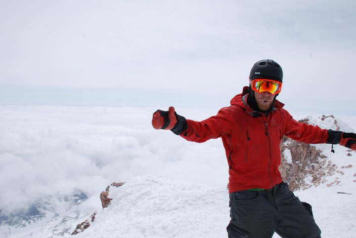
photo- Pollo on the summit of Shasta. photo by Mike Bannister.jpg
We geared up and dropped in. There was no real avalanche danger at the time and visibility was extremely poor most of the time, once we got beneath the top of Heartbreak Hill, so we skied/snowboarded slowly and very close together trying not to get separated in the clouds. Clouds opened up a bit in a few places for some good pictures up high:
photo- Mike Bannister skiing on Shasta. photo by Zach Taylor, 2011.
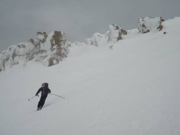
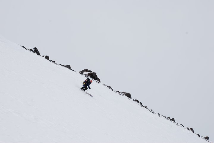
photo- Pollo skiing the "Heart" in Avalanche Gulch off Shasta. photo by Zach Taylor, 2011.
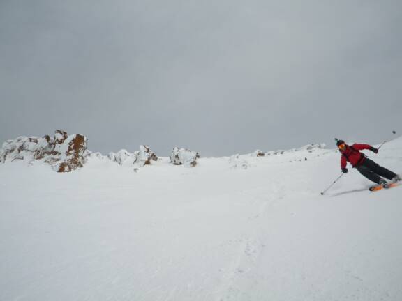
photo- Zach Taylor riding down Mt. Shasta. photo by Ricardo Moreno, 2011.
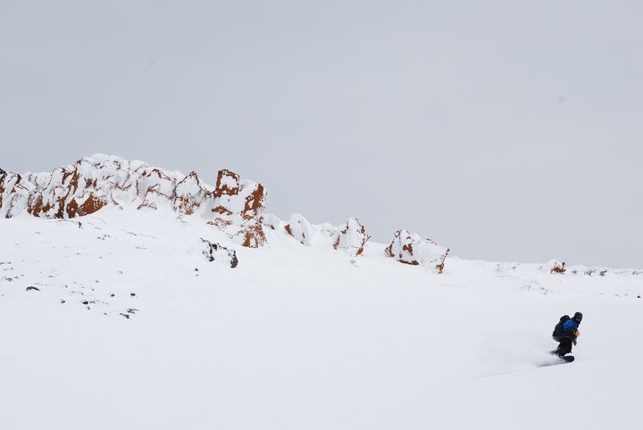
photo- Mike Bannister skiing down into the clouds on Mt. Shasta. photo by Ricardo Moreno, 2011.
photo- Mike Bannister skiing on Mt. Shasta. photo by Ricardo Moreno, 2011.
By the time we got below 13,000' we were completely socked into clouds and visibility was rarely better than about 40'. Getting down consisted of slowly riding down next to each other with many breaks for visibility to open up enough to see another rock or other landmark 100' below or so and making our way towards it while constantly referencing the GPS to make sure we were still on track. Visibility improved as we ducked out beneath the clouds at treeline and we made a quick beeline back to the trailhead from there.
We returned to the car tired and happy at 2:15pm. 7000 vertical feet is a big day. There are no peaks in Colorado with that kind of vertical so we were proud of covering that much distance in such a short period of time. We drove down to town and looked at weather for the rest of the trip. It looked like high pressure and sunshine starting in a couple days. We decided it was time to head towards Rainier since the weather window we were waiting for seemed to be moving in. We found somewhere to camp outside of Shasta that night and then headed north...
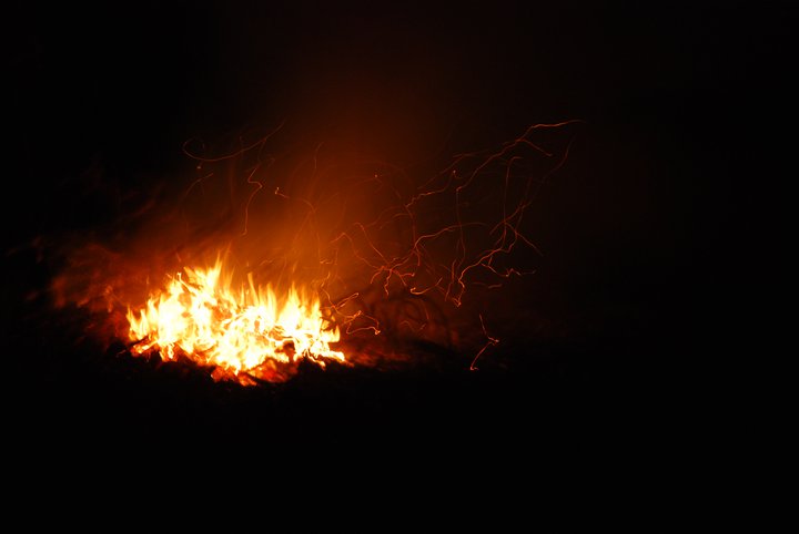
photo- Bonfire at camp after the summit. photo by Ricardo Moreno, 2011.